
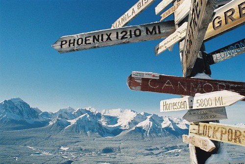
Navigation techniques
While maps are an indispensable tool for travel, they don’t always provide enough detail to get around. A map of Marrakech doesn’t show the maze of the medina. When one has to walk through a graveyard in Mexico to get to a remote beach, there isn’t a signpost saying ‘This Way‘. If you don’t know which road you’re on in Costa Rica, a map won’t help you figure it out.
As world travelers, we must also use our intuition to figure out where we are and where we’re going. By increasing our awareness, we can glean information from many sources to paint a clearer picture. For example, when hiking in the hills, a stream can lead you downhill to a river and possibly a bridge. Most of the world being north of the equator, the sun is generally to the south. In the morning it is also in the east, and in the afternoon the west. At night, the north star has guided explorers for millenia.
You can also estimate the time without a sundial if you have a general idea of when sunset or sunrise is and where in the world you are. Holding your arm outstretched and spreading your four fingers against the sky is about 15 degrees, or one hour. One has but to trace a line from the horizon to the sun, at an angle roughly equivalent to the latitude, and you can count the number of hands to get an idea for how many hours you have to get down off the mountain before nightfall.
Besides reading the heavens, one can obtain clues from the man-made world as well. When lost in Costa Rica a few years ago, a couple of passing buses with their destinations on the front helped us get going in the right direction. On our first night in Marrakech, trying to find our way through the labyrinth of the souqs to Djemaa el Fna, we could ask for directions to the bazaar from passers-by, but how would we get home? As we took turn after turn, we would look behind us and notice a particularly crenelated doorway, or a sign for ‘La vache qui rit‘, leaving behind a string of landmarks that we could follow home.
What techniques do you use to get around, when a map doesn’t suffice, or even exist?
(Photo by ninja_pixel via Flickr.)
November 12th, 2009 at 12:45 am
When I am in an unfamiliar town or city (which is more often than not), one of the first things I do when trying to get my bearings is normally to go for a walk around the block(s) where I am staying. This not only gives me a larger target to aim for when I am headed home (I am able to recognise the rough area of where I am staying, rather than just the front door of that guesthouse/hostel) but also gives me an idea of what the roads around the town are like (whether it is a grid pattern, a set of goats-trails which have been paved, etc.)
Next, I tend to try and find some easily recognisable landmarks, whether that is a structure or a natural landmark which is tall enough to be seen from most of the town (like a clock-tower, or a mountain/hill which stands over the town) or major streets which run through the city and can give me a “spine” to build my explorations off.
After that, it is a case of just wandering around, following my nose, getting lost, getting unlost, and generally getting an idea of what is where and how to get there. Some of the coolest things I have found, the friendliest people I have met, and the most memorable experiences I have had have all been in places I would never be able to find again (as much as I might try) which will probably never appear on any map anywhere.
November 12th, 2009 at 3:18 am
If someone says “look it up on their iphone” I’m gonna be upset.
November 12th, 2009 at 1:37 pm
Hahaha, Google Maps. (Joke 😉 When I’m in a foreign place I usually don’t worry about having a map. It somehow always works out! There is a difference when you’re at home driving around a city and when you’re all alone in a place with a different culture, language and currency. At home, you can rely on all the high tech gadgetry that is around assisting us where to go. It makes it easier on us because we don’t have to use our memory as much. When we don’t have these luxuries, we have to rely on… our own brain??? What a shock. The first thing I do is get out there! The map in your mind hasn’t been built yet. You build it through experiencing the area you’re in. Get lost. Find your way back. Now that gray mist has vanished into a clear knowledge of… oh ya, I know whats over there! You’ll be amazed at how quickly your mind will build it’s mental map of an area. You just need to pay a little more attention than when you’re driving with a gps.
Luke, I agree with the landmarks and streets as a spine to stem off of. That is a great idea. Everyone’s mind works differently when processing and organizing information so find what works best for you!
November 12th, 2009 at 4:56 pm
I follow the cats.
In both Croatia & Puerto Rico, I followed the stray cats. They led us interesting places we would not have otherwise found, with some of the most incredible views.
In Mexico, we followed the stray dogs through some of the lesser-known Mayan ruins, and they were excellent tour guides, living right under them. In other parts of the trip in nearby cities, the dogs would sometimes follow us.