
Get out of the guidebook rut
 Everyone has seen them, some of us have even been them — those poor travelers with their noses so buried in a guidebook they hardly seem aware of their surroundings. For most of us, the guidebook is an indispensable travel tool, but over-reliance on the guidebook can be hindrance as much as a help.
While tattered copies of Lonely Planet or Rough Guides may be be omnipresent theses days, over-reliance on guidebooks isn’t a recent development. Even Mark Twain laments guidebooks on his tour of the middle east, writing, “[Guidebook] authors write pictures and frame rhapsodies, and lesser men follow and see with the author’s eyes rather than their own.”
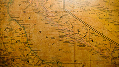
There is however, another way to travel. It might seem quaint to some, but the good old-fashioned map is still one of the best ways to explorer the world.
In this day and age, we need not limit “maps” to simply the cryptically folded paper maps you find in gas stations all over the world. In fact, while many are already lamenting (arguably a bit premature) the demise of the paper map, the truth is, for map nerds, the internet is the greatest thing since the sextant.
Heading out for unknown lands? Fire up Google Earth and do a fly over. Not only is it a fun way to visualize just how far away you’re going, you can get a feel for the terrain in the area. Google Earth is also a great way to find, for example, the perfect spot to spend a lazy sunset — just look for the highest point with good westerly lines of site.
I’ve found Flickr’s map explorer to be another great alternative to the guidebook — just head over to the map, plugin your destination and instantly pull up photographs from all over the area. Not only does it give you a visual tour of the area, it’s a great way to find hidden gems that no guidebook, no matter how thorough, could ever hope to cover.
Another interesting use for Flickr — further filter your map results by adding the dates of your trip from one year previous. Sorting through the results can give a rough idea of what sort of weather to expect.
Flickr also recently introduced Places, which the company calls “page on Flickr for every place in the world.”
Google Maps is another useful trip planner and with the recently added street views, it can be a great way to scope out guesthouses and hotels to see what sort of neighborhood they’re in. Google also has tons of custom maps, like the Tour de France map that offer’s street level views of specific routes.
Of course when you actually leave for a trip, the good old paper map can be your best friend, just don’t bury your nose so deep in the folds that you miss the real world around you.
Category: General, Vagabonding Advice